 South
Cotswold Soaring Association: Haresfield
South
Cotswold Soaring Association: Haresfield
 |
Haresfield:
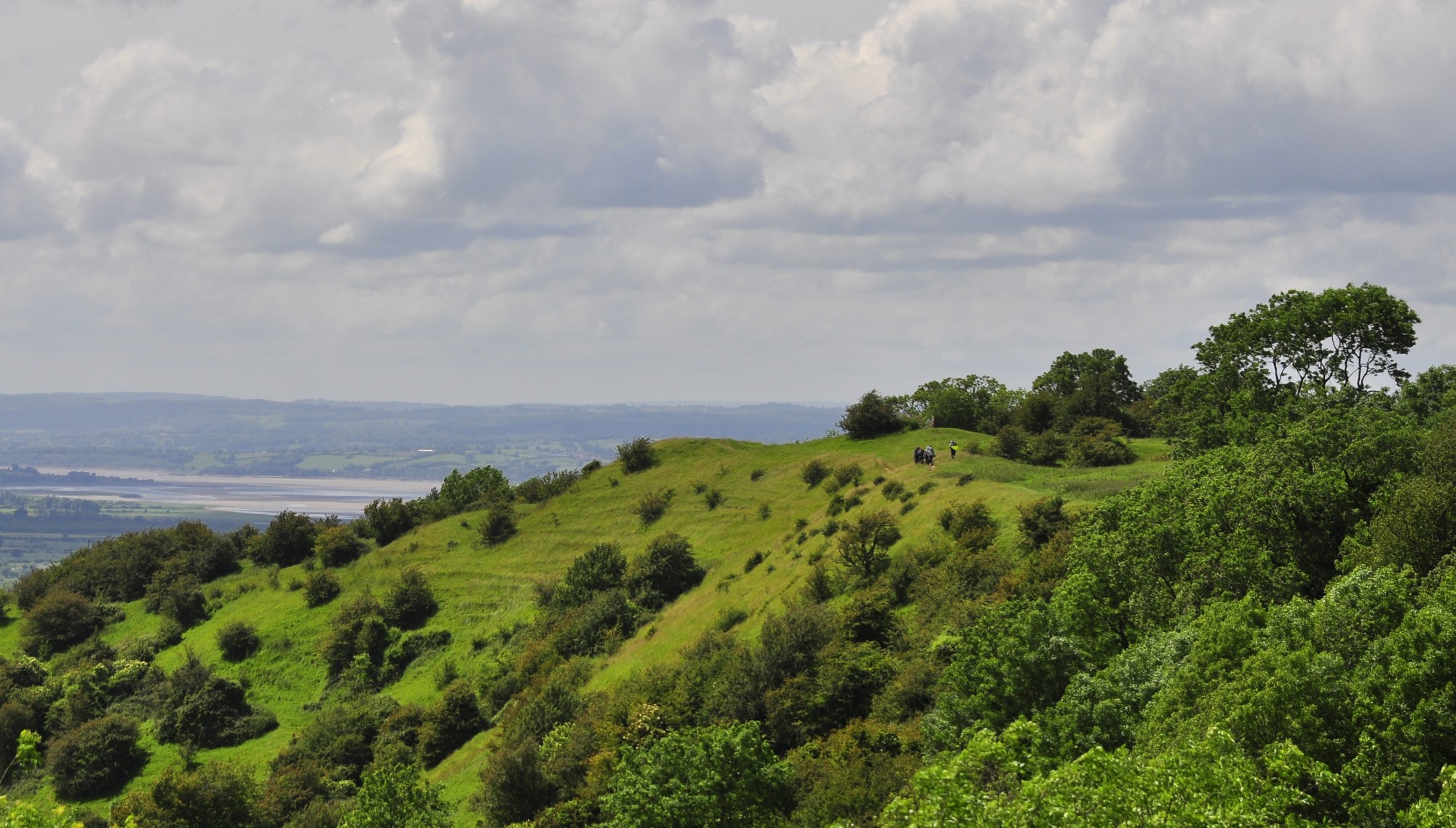
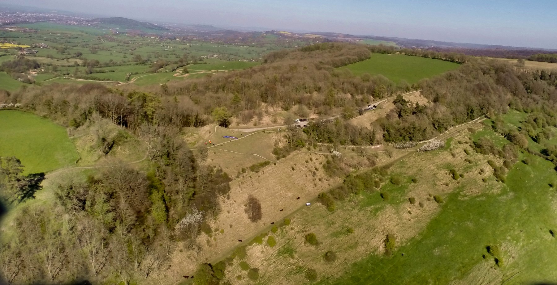
there are two slopes: the SSW facing near the car park and the
main South facing ridge on the way to trig point, these are model
breaking slopes. See
video
aerial footageThe small slope gives good lift from SSW to West, even when the wind is off the slope and coming from the right.
The large slope gives good lift from the south, if you start loosing height hug the slope (that means the model not you)
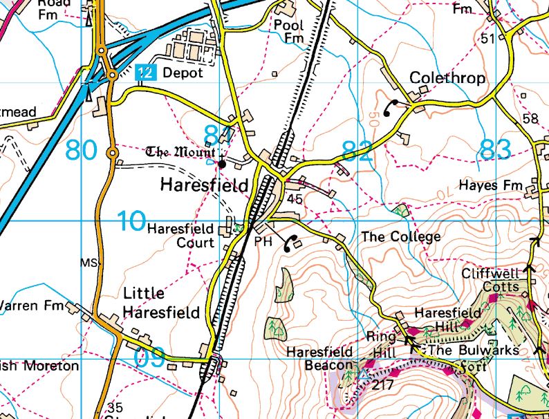
OS X (Eastings) 382485
OS Y (Northings) 209002
Lat (WGS84) N51:46:46 (51.779406)
Long (WGS84) W2:15:19 (-2.255282)
Lat,Long 51.779406,-2.255282
Nat Grid SO824090 / SO8248509002
mX -251056
mY 6726745
Mapcode GBR 1M4.DMS
what Three Words ///seagulls.albatross.rejoin
Directions:
hard to find, Satnav GL10 3ES is 1 mile north; from Haresfield travel up the steep hill past Ringhill farm, as the road gets less steep, there is off road parking, both sides of the road. Traveling from Edge or Whiteshill go half a mile past Cripplegate car park (marked P on the map). It is the Beacon you need not the view pointParking:
next to the small slope photo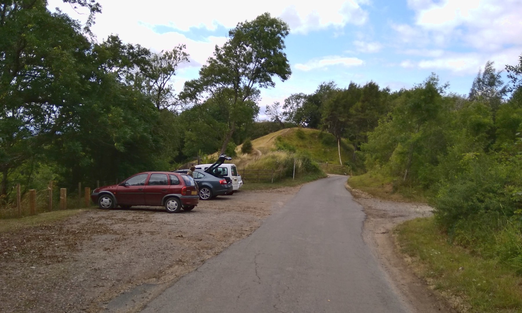
Landing
: there is a severe rotor on the south facing slope, it is hard to land on the small slope near the road.There are three options for landing on the main slope:
Land on the front of the slope (very tricky) see video
Take your chances with the rotor by landing behind the ridge
Walk to the right hand end of the slope and find the sweet spot where the wind sticks to the curve on the ridge (this is hard)
see video http://www.youtube Small slope landing top landing on large slope
Landing on the small slope see http://www.youtube.com/watch?v=qTAl_vtcrKQ
Landing out
: not too bad but it is a very steep climb back up the slopeParagliders:
not an easy slope, there is no landing place behind the slope and care is needed for a bottom landing, the main problems are the trees.
  |